Les Familles du DC 10 UTA Le Mémorial vu du ciel et par satellite Le site du Mémorial - 16° 51' 54" N - 11° 57' 13" E Photos Aviation sans Frontière, GeoEye et ADN télécharger le repère Google Earth (GoogleEarth_Memorial DC10.kmz) Retour à la galerie photo
Les Familles du DC 10 UTA
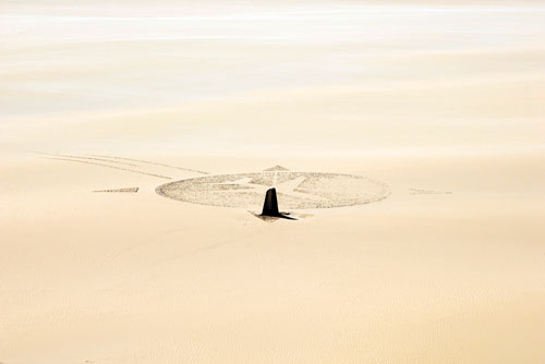
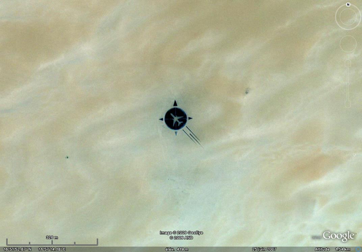
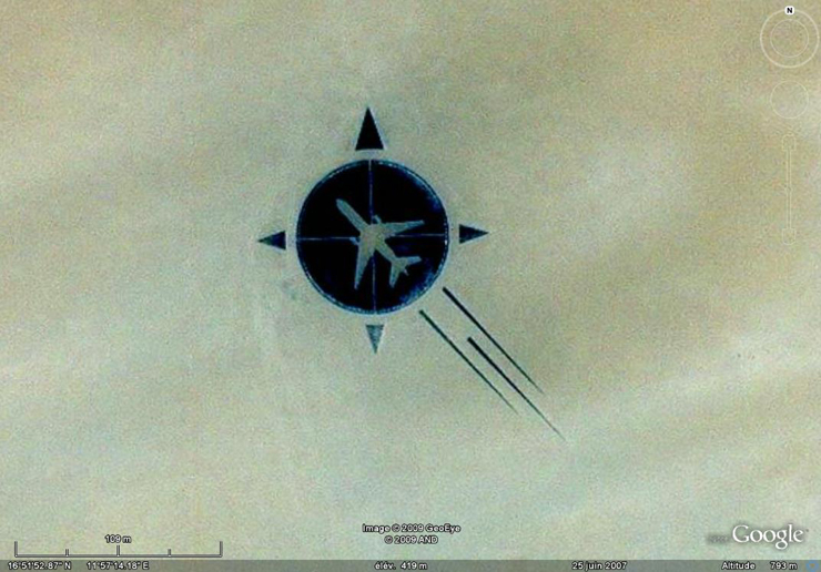
Le Mémorial vu du ciel et par satellite
Le site du Mémorial - 16° 51' 54" N - 11° 57' 13" E
Photos Aviation sans Frontière, GeoEye et ADN
télécharger le repère Google Earth (GoogleEarth_Memorial DC10.kmz)
Retour à la galerie photo